
Thank you for supporting this site ❤️
Make a donation
Make a donation
Gear up for your next adventure:
As an Amazon Associate, this site earns from qualifying purchases at no extra cost to you.
Ruwer topographic map
Click on the map to display elevation.
Thank you for supporting this site ❤️
Make a donation
Make a donation
Gear up for your next adventure:
As an Amazon Associate, this site earns from qualifying purchases at no extra cost to you.
About this map
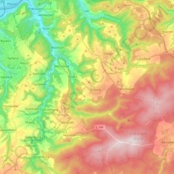
Name: Ruwer topographic map, elevation, terrain.
Location: Ruwer, Landkreis Trier-Saarburg, Rhineland-Palatinate, Germany (49.65077 6.68614 49.78325 6.87026)
Average elevation: 409 m
Minimum elevation: 121 m
Maximum elevation: 714 m
Thank you for supporting this site ❤️
Make a donation
Make a donation
Gear up for your next adventure:
As an Amazon Associate, this site earns from qualifying purchases at no extra cost to you.