
Thank you for supporting this site ❤️
Make a donation
Make a donation
Gear up for your next adventure:
As an Amazon Associate, this site earns from qualifying purchases at no extra cost to you.
Arriondas / Les Arriondes topographic map
Click on the map to display elevation.
Thank you for supporting this site ❤️
Make a donation
Make a donation
Gear up for your next adventure:
As an Amazon Associate, this site earns from qualifying purchases at no extra cost to you.
About this map
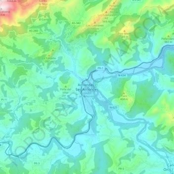
Name: Arriondas / Les Arriondes topographic map, elevation, terrain.
Location: Arriondas / Les Arriondes, Parres, Asturias, 33540, Spain (43.34922 -5.22487 43.42922 -5.14487)
Average elevation: 187 m
Minimum elevation: 12 m
Maximum elevation: 951 m
Thank you for supporting this site ❤️
Make a donation
Make a donation
Gear up for your next adventure:
As an Amazon Associate, this site earns from qualifying purchases at no extra cost to you.