Geolocate

Prarotto topographic map

Click on the map to display elevation.

About this map
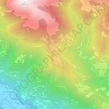
Name: Prarotto topographic map, elevation, terrain.

Location: Prarotto, Condove, Turin, Piedmont, Italy (45.12890 7.21693 45.16890 7.25693)

Average elevation: 1,190 m

Minimum elevation: 401 m

Maximum elevation: 2,080 m

Gear up for your next adventure:

🗺️Ordnance Survey Maps - Official UK maps for walking and outdoor activities
🐕Hiking Dog Harnesses - Rugged harnesses for taking your companion on mountain trails
🌄Outdoor Binoculars - Compact binoculars for landscape observation
🛰️Satellite Messengers - Emergency communication devices for areas without mobile signal
🧺Ultralight Dry Bags - Organize and waterproof your gear inside your rucksack

As an Amazon Associate, this site earns from qualifying purchases at no extra cost to you.