Geolocate

Koni topographic map

Click on the map to display elevation.

About this map

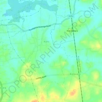
Name: Koni topographic map, elevation, terrain.

Location: Koni, Kundapura, Udupi, Karnataka, India (13.58276 74.70733 13.62501 74.72686)

Average elevation: 12 m

Minimum elevation: -1 m

Maximum elevation: 34 m

Gear up for your next adventure:

Insulated Travel Mugs - Keep drinks hot while surveying the landscape from a summit
📸Action Camera Chest Mounts - Record your ascent following topographic paths hands-free
💧Hydration Reservoirs - Convenient water bladders for hands-free drinking on the move
🔦Head Torches - Hands-free lighting for hiking and camping
🧴Tick Removal Tools - Small, essential health tool for UK woodland and moorland

As an Amazon Associate, this site earns from qualifying purchases at no extra cost to you.