Geolocate

Chester topographic map

Click on the map to display elevation.

About this map

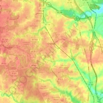
Name: Chester topographic map, elevation, terrain.

Location: Chester, Chesterfield County, Virginia, 23831, United States (37.30783 -77.48045 37.39182 -77.39971)

Average elevation: 45 m

Minimum elevation: 1 m

Maximum elevation: 69 m

Other topographic maps

Click on a map to view its topography, its elevation and its terrain.

Chester

United States > Virginia > Chesterfield County

Average elevation: 46 m

Gear up for your next adventure:

📍Handheld GPS Navigators - Reliable satellite navigation for hiking and off-road exploration
🔋Lithium AA Batteries - Long-lasting power that performs well in cold mountain weather
🧺Ultralight Dry Bags - Organize and waterproof your gear inside your rucksack
🧥Waterproof Hiking Jackets - Rain protection for walking in all weather conditions
🔦LED Camping Lanterns - Illumination for reading maps inside your tent at night

As an Amazon Associate, this site earns from qualifying purchases at no extra cost to you.