Geolocate

Valley topographic map

Click on the map to display elevation.

About this map

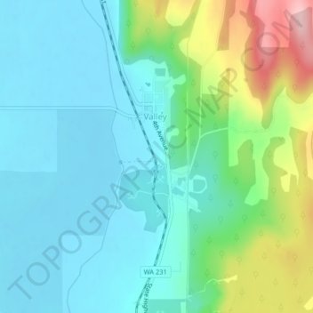
Name: Valley topographic map, elevation, terrain.

Location: Valley, Stevens County, Washington, United States (48.16279 -117.73032 48.18062 -117.71846)

Average elevation: 555 m

Minimum elevation: 504 m

Maximum elevation: 710 m

Gear up for your next adventure:

🔥Reusable Hand Warmers - Maintain dexterity in your fingers for precise map handling
🧺Mesh Stuff Sacks - Breathable storage for wet gear or camp organization
Insulated Travel Mugs - Keep drinks hot while surveying the landscape from a summit
👟Men's Trail Running Shoes - Lightweight grip for fast movement over topographic contours
Lightweight Tents - Compact tents for backpacking and trekking

As an Amazon Associate, this site earns from qualifying purchases at no extra cost to you.