Geolocate

Carthage topographic map

Click on the map to display elevation.

About this map
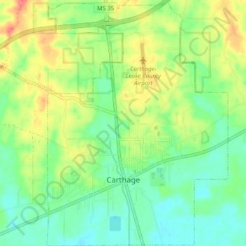
Name: Carthage topographic map, elevation, terrain.

Location: Carthage, Leake County, Mississippi, United States (32.71653 -89.55817 32.77611 -89.50604)

Average elevation: 117 m

Minimum elevation: 94 m

Maximum elevation: 154 m

Other topographic maps

Click on a map to view its topography, its elevation and its terrain.

Gray

United States > Mississippi > Leake County

Average elevation: 129 m

Gear up for your next adventure:

🧥Packable Down Jackets - Lightweight warmth that compresses small in your bag
🧭Professional Hiking Compasses - High-precision liquid-filled compasses for map reading and orientation
🔦Keychain LED Torches - Emergency backup light for finding gear in your pack
🚶Walking Pedometers - Simple distance tracking for casual trail walkers
🔭Compact Hiking Binoculars - Lightweight optics for scouting terrain and spotting wildlife

As an Amazon Associate, this site earns from qualifying purchases at no extra cost to you.