
Wädenswil topographic map
Interactive map
Click on the map to display elevation.
About this map
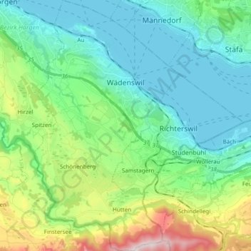
Name: Wädenswil topographic map, elevation, terrain.
Location: Wädenswil, Bezirk Horgen, Zurich, 8820, Switzerland (47.15944 8.61516 47.26122 8.70195)
Average elevation: 597 m
Minimum elevation: 401 m
Maximum elevation: 1,217 m