Geolocate

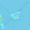
Heist topographic map

Click on the map to display elevation.

About this map

Name: Heist topographic map, elevation, terrain.

Location: Heist, Amt Geest und Marsch Südholstein, Kreis Pinneberg, Schleswig-Holstein, 25492, Germany (53.63186 9.63998 53.66533 9.71515)

Average elevation: 6 m

Minimum elevation: -2 m

Maximum elevation: 17 m

Other topographic maps

Click on a map to view its topography, its elevation and its terrain.

Knust

Germany > Schleswig-Holstein > Kreis Pinneberg > Quickborn

Average elevation: 14 m

Gear up for your next adventure:

🗺️Topographic Maps - Detailed maps showing elevation and terrain features
🗺️Ordnance Survey Maps - Essential paper maps for hiking across the UK national parks
📐Altimeters & Barometers - Tools for measuring altitude and air pressure
🔭Compact Hiking Binoculars - Lightweight optics for scouting terrain and spotting wildlife
🧥Packable Down Jackets - Lightweight warmth that compresses small in your bag

As an Amazon Associate, this site earns from qualifying purchases at no extra cost to you.