Geolocate

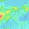
Isthmus Path Prairie Garden topographic map

Click on the map to display elevation.

About this map

Name: Isthmus Path Prairie Garden topographic map, elevation, terrain.

Location: Isthmus Path Prairie Garden, Marquette, Madison, Dane County, Wisconsin, 53703, United States (43.07887 -89.37235 43.08017 -89.37053)

Average elevation: 262 m

Minimum elevation: 256 m

Maximum elevation: 290 m

Other topographic maps

Click on a map to view its topography, its elevation and its terrain.
Summit Woods

United States > Wisconsin > Dane County > Madison

Average elevation: 302 m

Burke

United States > Wisconsin > Dane County > Madison

Average elevation: 292 m

Nobel Park

United States > Wisconsin > Dane County > Madison

Average elevation: 273 m

Bowens Addition

United States > Wisconsin > Dane County > Madison

Average elevation: 266 m

Summit Woods

United States > Wisconsin > Dane County > Madison

Average elevation: 302 m

Gear up for your next adventure:

🧼Biodegradable Soap - Leave-no-trace hygiene for multi-day mountain treks
👕Technical Hiking Tees - Moisture-management for high-exertion climbs
👕Merino Base Layers - Natural temperature regulation for cold weather hiking and camping
👟Women's Trail Running Shoes - Agile footwear for fell running and technical trails
🔦Head Torches - Hands-free lighting for hiking and camping

As an Amazon Associate, this site earns from qualifying purchases at no extra cost to you.