
Thank you for supporting this site ❤️
Make a donation
Make a donation
Gear up for your next adventure:
As an Amazon Associate, this site earns from qualifying purchases at no extra cost to you.
Stettler topographic map
Click on the map to display elevation.
Thank you for supporting this site ❤️
Make a donation
Make a donation
Gear up for your next adventure:
As an Amazon Associate, this site earns from qualifying purchases at no extra cost to you.
About this map
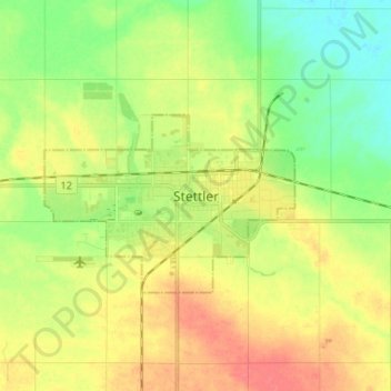
Name: Stettler topographic map, elevation, terrain.
Location: Stettler, Town of Stettler, Alberta, T0C 2L2, Canada (52.28287 -112.75302 52.36287 -112.67302)
Average elevation: 819 m
Minimum elevation: 793 m
Maximum elevation: 848 m
Thank you for supporting this site ❤️
Make a donation
Make a donation
Gear up for your next adventure:
As an Amazon Associate, this site earns from qualifying purchases at no extra cost to you.