
Thank you for supporting this site ❤️
Make a donation
Make a donation
Gear up for your next adventure:
As an Amazon Associate, this site earns from qualifying purchases at no extra cost to you.
Rangpo topographic map
Click on the map to display elevation.
Thank you for supporting this site ❤️
Make a donation
Make a donation
Gear up for your next adventure:
As an Amazon Associate, this site earns from qualifying purchases at no extra cost to you.
About this map
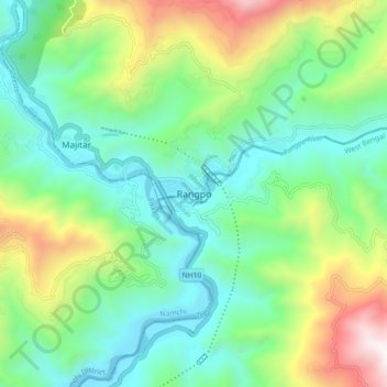
Name: Rangpo topographic map, elevation, terrain.
Location: Rangpo, Pakyong subdivision, Pakyong, Sikkim, 737132, India (27.13444 88.49034 27.21444 88.57034)
Average elevation: 731 m
Minimum elevation: 248 m
Maximum elevation: 1,877 m
Thank you for supporting this site ❤️
Make a donation
Make a donation
Gear up for your next adventure:
As an Amazon Associate, this site earns from qualifying purchases at no extra cost to you.