Geolocate

Alaminos topographic map

Click on the map to display elevation.

About this map

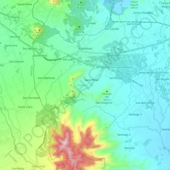
Name: Alaminos topographic map, elevation, terrain.

Location: Alaminos, Laguna, Calabarzon, 4001, Philippines (13.98195 121.20904 14.09801 121.29012)

Average elevation: 206 m

Minimum elevation: 50 m

Maximum elevation: 762 m

Gear up for your next adventure:

🔋Lithium AA Batteries - Long-lasting power that performs well in cold mountain weather
👟Waterproof Leg Gaiters - Keep mud and water out of your boots in boggy terrain
👟Women's Trail Running Shoes - Agile footwear for fell running and technical trails
👟Heavy Duty Boot Laces - Always carry a spare for your hiking footwear
🔥Reusable Hand Warmers - Maintain dexterity in your fingers for precise map handling

As an Amazon Associate, this site earns from qualifying purchases at no extra cost to you.