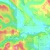
Vernonia topographic map
Click on the map to display elevation.
Vernonia
The city has been severely impacted by floods on multiple occasions. The rains that caused the Willamette Valley Flood of 1996 flooded Vernonia as well; some homes in the floodplain were elevated, and some flooring materials were replaced, mitigating some damage from later flooding. In 2007, heavy storms that impacted the Pacific Northwest washed out roads and destroyed homes, cars, and communications infrastructure. Despite preparations in 1996, in some parts of town flood water reached 4 feet (1.2 m) above the 100 year base flood elevation. In the wake of the 2007 flood, Vernonia School District voters approved a $13 million bond in 2009 to build a new K-12 school in Vernonia. The new school opened in fall 2012.
About this map

Name: Vernonia topographic map, elevation, terrain.
Location: Vernonia, Columbia County, Oregon, United States (45.85173 -123.20641 45.87150 -123.15945)
Average elevation: 218 m
Minimum elevation: 174 m
Maximum elevation: 321 m
Other topographic maps
Click on a map to view its topography, its elevation and its terrain.