Geolocate

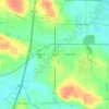
Norton topographic map

Click on the map to display elevation.

About this map

Name: Norton topographic map, elevation, terrain.

Location: Norton, Summit County, Ohio, United States (40.98230 -81.68850 41.06245 -81.58882)

Average elevation: 323 m

Minimum elevation: 288 m

Maximum elevation: 386 m

Other topographic maps

Click on a map to view its topography, its elevation and its terrain.
Boston

United States > Ohio > Summit County

Average elevation: 245 m

Greensburg

United States > Ohio > Summit County > Green

Average elevation: 358 m

Six Corners

United States > Ohio > Summit County > Tallmadge

Average elevation: 350 m

Metz

United States > Ohio > Summit County > Stow

Average elevation: 318 m

Copley

United States > Ohio > Summit County

Average elevation: 318 m

North Springfield

United States > Ohio > Summit County > Akron

Average elevation: 336 m

Copley

United States > Ohio > Summit County

Average elevation: 318 m

Copley

United States > Ohio > Summit County

Average elevation: 318 m

Sagamore Hills

United States > Ohio > Summit County

Average elevation: 264 m

Maple Grove Park

United States > Ohio > Summit County > Hudson

Average elevation: 316 m

Gear up for your next adventure:

🧭GPS Trackers - Tracking devices for safety and navigation
🦶Anti-Blister Balms - Protect your feet before long topographic expeditions
🔋Solar Power Banks - Keep your GPS and phone charged during multi-day expeditions
🧭Emergency Beacons - Safety beacons for remote outdoor locations
👕Technical Hiking Tees - Moisture-management for high-exertion climbs

As an Amazon Associate, this site earns from qualifying purchases at no extra cost to you.