Geolocate

Peize topographic map

Click on the map to display elevation.

About this map

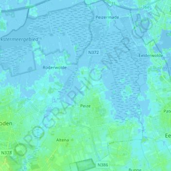
Name: Peize topographic map, elevation, terrain.

Location: Peize, Noordenveld, Drenthe, Netherlands (53.11738 6.45373 53.20015 6.54009)

Average elevation: 1 m

Minimum elevation: -5 m

Maximum elevation: 10 m

Gear up for your next adventure:

🌂Windproof Trekking Umbrellas - Surprising but effective rain protection on low-wind trails
📦Compression Sacks - Reduce backpack volume efficiently
🍱Food Containers - Reusable containers for outdoor meals
🧭GPS Trackers - Tracking devices for safety and navigation
🗺️Scratch-off Peak Maps - Track your progress climbing Munros or Wainwrights

As an Amazon Associate, this site earns from qualifying purchases at no extra cost to you.