Geolocate

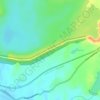
Donwat topographic map

Click on the map to display elevation.

About this map

Name: Donwat topographic map, elevation, terrain.

Location: Donwat, Khalapur Taluka, Raigad, Maharashtra, India (18.75861 73.23259 18.79861 73.27259)

Average elevation: 105 m

Minimum elevation: 62 m

Maximum elevation: 296 m

Other topographic maps

Click on a map to view its topography, its elevation and its terrain.

Khalapur Gaon

India > Maharashtra > Khalapur Taluka

Average elevation: 66 m

Morbe Dam

India > Maharashtra > Khalapur Taluka > Chowk

Average elevation: 61 m

Patalganga

India > Maharashtra > Khalapur Taluka > Jambrung

Average elevation: 95 m

Gear up for your next adventure:

🐕Hiking Dog Harnesses - Rugged harnesses for taking your companion on mountain trails
📚UK Hiking Guidebooks - Detailed route descriptions for the Lake District, Peaks, and Highlands
🎒Hiking Child Carriers - Explore the outdoors with the whole family safely
🛌Insulated Sleeping Mats - Crucial thermal protection when sleeping on cold, uneven ground
👟Waterproof Leg Gaiters - Keep mud and water out of your boots in boggy terrain

As an Amazon Associate, this site earns from qualifying purchases at no extra cost to you.