Geolocate

Rolde topographic map

Click on the map to display elevation.

About this map

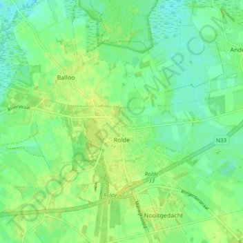
Name: Rolde topographic map, elevation, terrain.

Location: Rolde, Aa en Hunze, Drenthe, Netherlands (52.97156 6.60739 53.00392 6.68260)

Average elevation: 14 m

Minimum elevation: 6 m

Maximum elevation: 21 m

Gear up for your next adventure:

🧴Sport Sunscreen Sticks - High-protection sunblock that won't run into your eyes on the trail
🧴Tick Removal Tools - Small, essential health tool for UK woodland and moorland
🗺️Topographic Maps - Detailed maps showing elevation and terrain features
🔦Outdoor Torches - Reliable torches for night navigation
🧥Breathable Waterproof Jackets - Essential rain protection for the unpredictable British climate

As an Amazon Associate, this site earns from qualifying purchases at no extra cost to you.