Geolocate

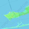
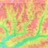
Tiger Point topographic map

Click on the map to display elevation.

About this map

Name: Tiger Point topographic map, elevation, terrain.

Location: Tiger Point, Santa Rosa County, Florida, 32563, United States (30.35853 -87.07552 30.39853 -87.03552)

Average elevation: 4 m

Minimum elevation: 0 m

Maximum elevation: 15 m

Other topographic maps

Click on a map to view its topography, its elevation and its terrain.
Milton

United States > Florida > Santa Rosa County

Average elevation: 15 m

Pace

United States > Florida > Santa Rosa County > Pace

Average elevation: 17 m

Jay

United States > Florida > Santa Rosa County

Average elevation: 79 m

Milton

United States > Florida > Santa Rosa County

Average elevation: 15 m

Pace

United States > Florida > Santa Rosa County > Pace

Average elevation: 17 m

Pace

United States > Florida > Santa Rosa County > Pace

Average elevation: 17 m

Bagdad

United States > Florida > Santa Rosa County

Average elevation: 10 m

Pace

United States > Florida > Santa Rosa County > Pace

Average elevation: 17 m

Jay

United States > Florida > Santa Rosa County

Average elevation: 79 m

Jay

United States > Florida > Santa Rosa County

Average elevation: 79 m

Gear up for your next adventure:

🧊Personal Water Filters - Drink safely from mountain streams marked on your map
👖Packable Overtrousers - Quick-deploy rain protection for legs in sudden storms
⛺Lightweight Tents - Compact tents for backpacking and trekking
☕Insulated Travel Mugs - Keep drinks hot while surveying the landscape from a summit
🕶️Polarized Sunglasses - Reduces glare from snow and water when reading terrain

As an Amazon Associate, this site earns from qualifying purchases at no extra cost to you.