Geolocate

Talim Island topographic map

Click on the map to display elevation.

About this map

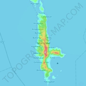
Name: Talim Island topographic map, elevation, terrain.

Location: Talim Island, Ginoong Sanay, Rizal, Calabarzon, Philippines (14.28701 121.21394 14.42266 121.26637)

Average elevation: 13 m

Minimum elevation: -5 m

Maximum elevation: 411 m

Gear up for your next adventure:

🥼Base Layers - Thermal base layers for temperature regulation
📢Survival Whistles - Essential safety gear for signaling for help in mountain fog
🚲Cycling GPS Computers - Track elevation and topographic routes on two wheels
🕶️Glacier Goggles - Maximum protection for high-altitude snow topography
🛌Sleeping Mats - Insulated mats for comfortable outdoor sleeping

As an Amazon Associate, this site earns from qualifying purchases at no extra cost to you.