
Thank you for supporting this site ❤️
Make a donation
Make a donation
Gear up for your next adventure:
As an Amazon Associate, this site earns from qualifying purchases at no extra cost to you.
Lantz topographic map
Click on the map to display elevation.
Thank you for supporting this site ❤️
Make a donation
Make a donation
Gear up for your next adventure:
As an Amazon Associate, this site earns from qualifying purchases at no extra cost to you.
About this map
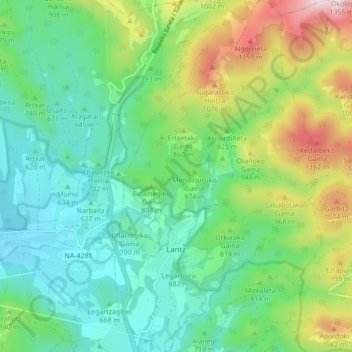
Name: Lantz topographic map, elevation, terrain.
Location: Lantz, Iruñerria / Comarca de Pamplona, Navarre, 31798, Spain (42.97971 -1.63481 43.04305 -1.58358)
Average elevation: 774 m
Minimum elevation: 544 m
Maximum elevation: 1,323 m
Thank you for supporting this site ❤️
Make a donation
Make a donation
Gear up for your next adventure:
As an Amazon Associate, this site earns from qualifying purchases at no extra cost to you.
Other topographic maps
Click on a map to view its topography, its elevation and its terrain.
Zulueta
Spain > Navarre > Iruñerria / Comarca de Pamplona > Valle de Elorz / Elortzibar
Average elevation: 522 m