Hagerstown topographic map
Click on the map to display elevation.
Hagerstown
Hagerstown has a distinct topography, formed by stone ridges running from northeast to southwest through the center of town. Geography accordingly bounds its neighborhoods. These ridges consist of upper Stonehenge Limestone. Many of the older buildings were built from this stone, which is easily quarried and dressed onsite. It whitens in weathering and the edgewise conglomerate and wavy laminae become distinctly visible, giving an appearance unique to the Cumberland Valley as seen in the architecture of St. John's Episcopal Church.
About this map
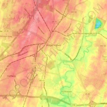
Name: Hagerstown topographic map, elevation, terrain.
Location: Hagerstown, Washington County, Maryland, United States (39.60003 -77.77309 39.67373 -77.67228)
Average elevation: 170 m
Minimum elevation: 102 m
Maximum elevation: 204 m
Other topographic maps
Click on a map to view its topography, its elevation and its terrain.

Antietam National Battlefield
United States > Maryland > Washington County > Sharpsburg
Average elevation: 147 m