
Singapore Township topographic map
Interactive map
Click on the map to display elevation.
About this map
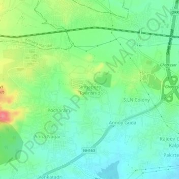
Name: Singapore Township topographic map, elevation, terrain.
Average elevation: 485 m
Minimum elevation: 457 m
Maximum elevation: 545 m
Other topographic maps
Click on a map to view its topography, its elevation and its terrain.
Ghatkesar
India > Telangana > Ghatkesar mandal
Ghatkesar, Ghatkesar mandal, Medchal–Malkajgiri District, Telangana, 501301, India
Average elevation: 482 m
Pocharam
India > Telangana > Ghatkesar mandal > Pocharam
Pocharam, Ghatkesar mandal, Medchal–Malkajgiri, Telangana, 501301, India
Average elevation: 487 m
Narepally
India > Telangana > Ghatkesar mandal > Narepally
Narepally, Ghatkesar mandal, Medchal–Malkajgiri, Telangana, 500098, India
Average elevation: 486 m