Geolocate

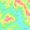
Runruno topographic map

Click on the map to display elevation.

About this map

Name: Runruno topographic map, elevation, terrain.

Location: Runruno, Nueva Vizcaya, Cagayan Valley, Philippines (16.40550 121.30377 16.44550 121.34377)

Average elevation: 586 m

Minimum elevation: 358 m

Maximum elevation: 943 m

Other topographic maps

Click on a map to view its topography, its elevation and its terrain.
Kasibu River

Philippines > Nueva Vizcaya > Kasibu

Average elevation: 866 m

Casecnan River

Philippines > Nueva Vizcaya > Pelaway

Average elevation: 963 m

Kayapa

Philippines > Nueva Vizcaya

Average elevation: 1,258 m

Gear up for your next adventure:

🧺Ultralight Dry Bags - Organize and waterproof your gear inside your rucksack
📐Altimeters & Barometers - Tools for measuring altitude and air pressure
🧣Neck Gaiters - Protects against wind and sun on exposed ridges and peaks
🗺️Scratch-off Peak Maps - Track your progress climbing Munros or Wainwrights
🧘Folding Sit Mats - Dry and warm seat for map-reading breaks on damp ground

As an Amazon Associate, this site earns from qualifying purchases at no extra cost to you.