Geolocate

Hideout topographic map

Click on the map to display elevation.

About this map

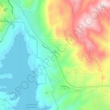
Name: Hideout topographic map, elevation, terrain.

Location: Hideout, Wasatch County, Utah, United States (40.62422 -111.42647 40.66967 -111.37668)

Average elevation: 2,067 m

Minimum elevation: 1,869 m

Maximum elevation: 2,420 m

Gear up for your next adventure:

🔋Solar Chargers - Eco-friendly charging solutions for outdoor use
🦯Walking Poles - Supportive poles for long-distance walking
🧺Microfibre Travel Towels - Fast-drying and compact towels for wild swimming and camping
🧥Waterproof Hiking Jackets - Rain protection for walking in all weather conditions
📱Rugged Phone Cases - Heavy-duty protection for smartphones used as secondary GPS tools

As an Amazon Associate, this site earns from qualifying purchases at no extra cost to you.