
West Liberty topographic map
Interactive map
Click on the map to display elevation.
About this map
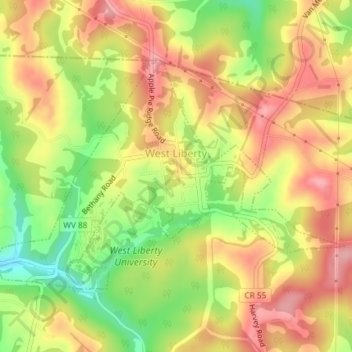
Name: West Liberty topographic map, elevation, terrain.
Location: West Liberty, Ohio County, West Virginia, United States (40.15892 -80.61269 40.17702 -80.57595)
Average elevation: 354 m
Minimum elevation: 280 m
Maximum elevation: 412 m
Other topographic maps
Click on a map to view its topography, its elevation and its terrain.
Clearview
United States > West Virginia > Ohio County
Clearview, Ohio County, West Virginia, United States
Average elevation: 302 m