
Billerbeck topographic map
Interactive map
Click on the map to display elevation.
About this map
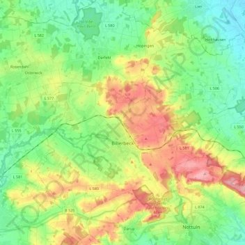
Name: Billerbeck topographic map, elevation, terrain.
Average elevation: 113 m
Minimum elevation: 67 m
Maximum elevation: 191 m
Other topographic maps
Click on a map to view its topography, its elevation and its terrain.
Lüdinghausen
Germany > North Rhine-Westphalia > Kreis Coesfeld
Lüdinghausen, Kreis Coesfeld, North Rhine-Westphalia, 59348, Germany
Average elevation: 62 m
Coesfeld
Germany > North Rhine-Westphalia > Kreis Coesfeld > Coesfeld
Coesfeld, Kreis Coesfeld, North Rhine-Westphalia, 48653, Germany
Average elevation: 85 m