
Astley topographic map
Interactive map
Click on the map to display elevation.
About this map
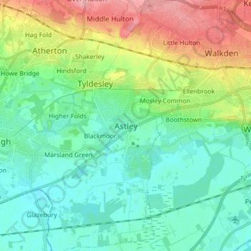
Name: Astley topographic map, elevation, terrain.
Average elevation: 44 m
Minimum elevation: 12 m
Maximum elevation: 121 m
Routes: Greater Manchester GPS tracks, routes, trails, hikes
Other topographic maps
Click on a map to view its topography, its elevation and its terrain.
Astley Green
United Kingdom > England > Greater Manchester > Astley > Astley Green
Average elevation: 26 m