Geolocate

Baratan topographic map

Click on the map to display elevation.

About this map

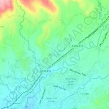
Name: Baratan topographic map, elevation, terrain.

Location: Baratan, Jember, East Java, 68111, Indonesia (-8.16798 113.69755 -8.12798 113.73755)

Average elevation: 122 m

Minimum elevation: 82 m

Maximum elevation: 232 m

Gear up for your next adventure:

🔭Compact Hiking Binoculars - Lightweight optics for scouting terrain and spotting wildlife
📦Dry Bags - Waterproof bags to protect gear from rain
🔋Rechargeable Batteries - Eco-friendly power for headlamps and older GPS units
📦Compression Sacks - Reduce backpack volume efficiently
🖼️Topographic Map Art - Decorative 3D-effect posters of famous UK peaks and regions

As an Amazon Associate, this site earns from qualifying purchases at no extra cost to you.