Geolocate

Narkanda topographic map

Click on the map to display elevation.

About this map

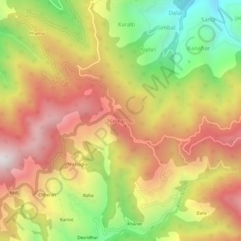
Name: Narkanda topographic map, elevation, terrain.

Location: Narkanda, Kumharsain, Shimla, Himachal Pradesh, 171213, India (31.23475 77.44127 31.27475 77.48127)

Average elevation: 2,466 m

Minimum elevation: 1,845 m

Maximum elevation: 3,008 m

Gear up for your next adventure:

🌂Windproof Trekking Umbrellas - Surprising but effective rain protection on low-wind trails
📕Outdoor Navigation Books - Learn traditional and modern navigation techniques
🧼Technical Clothing Wash - Special soap to clean and restore waterproof membranes
🛌Sleeping Mats - Insulated mats for comfortable outdoor sleeping
🦶Anti-Blister Balms - Protect your feet before long topographic expeditions

As an Amazon Associate, this site earns from qualifying purchases at no extra cost to you.