
Thank you for supporting this site ❤️
Make a donation
Make a donation
Gear up for your next adventure:
As an Amazon Associate, this site earns from qualifying purchases at no extra cost to you.
Prusia topographic map
Click on the map to display elevation.
Thank you for supporting this site ❤️
Make a donation
Make a donation
Gear up for your next adventure:
As an Amazon Associate, this site earns from qualifying purchases at no extra cost to you.
About this map
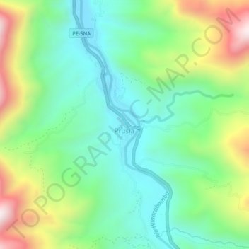
Name: Prusia topographic map, elevation, terrain.
Location: Prusia, Pozuzo, Province of Oxapampa, Pasco, 19251, Peru (-10.11680 -75.56255 -10.07680 -75.52255)
Average elevation: 989 m
Minimum elevation: 718 m
Maximum elevation: 1,549 m
Thank you for supporting this site ❤️
Make a donation
Make a donation
Gear up for your next adventure:
As an Amazon Associate, this site earns from qualifying purchases at no extra cost to you.