
Rifle topographic map
Interactive map
Click on the map to display elevation.
About this map
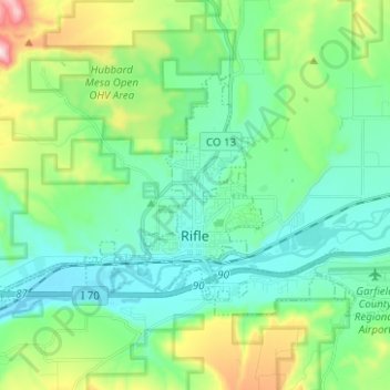
Name: Rifle topographic map, elevation, terrain.
Location: Rifle, Garfield County, Colorado, 81650, United States (39.51492 -107.84737 39.57478 -107.72263)
Average elevation: 1,731 m
Minimum elevation: 1,598 m
Maximum elevation: 2,149 m
Other topographic maps
Click on a map to view its topography, its elevation and its terrain.
New Castle
United States > Colorado > Garfield County
New Castle, Garfield County, Colorado, 81647, United States
Average elevation: 1,811 m
Glenwood Springs
United States > Colorado > Garfield County
Glenwood Springs, Garfield County, Colorado, 81601, United States
Average elevation: 2,079 m
Catherine
United States > Colorado > Garfield County
Catherine, Garfield County, Colorado, United States
Average elevation: 2,020 m