Sibu topographic map
Click on the map to display elevation.
Sibu
Sibu is located near the Rajang delta at the confluence of Rajang and Igan rivers. Peat swamp forests and alluvial plains are particularly prevalent in the Sibu Division. Sibu is located on a deep peat soil, which has caused problems in infrastructure development because buildings and roads slowly sink into the ground after its completion. The location of Sibu in lowland peat swamps have subjected it to frequent floods, about 1 to 3 times per year. Because of these factors, the Sibu Flood Mitigation project was started to relieve the area from the floods. The highest elevation in Sibu is at Bukit Aup Jubilee Park, measuring 59 m above sea level.
About this map
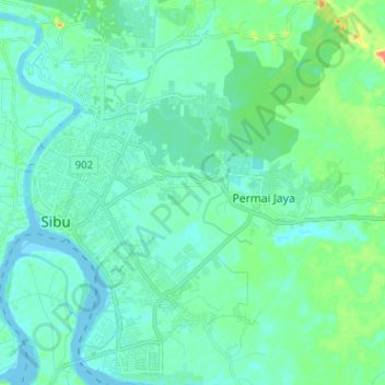
Name: Sibu topographic map, elevation, terrain.
Location: Sibu, Sibu Division, Sarawak, 96000, Malaysia (2.23627 111.81461 2.36353 111.92486)
Average elevation: 9 m
Minimum elevation: -4 m
Maximum elevation: 46 m
Other topographic maps
Click on a map to view its topography, its elevation and its terrain.