
War Memorial Park topographic map
Interactive map
Click on the map to display elevation.
About this map
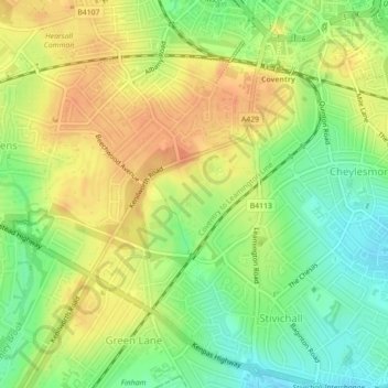
Name: War Memorial Park topographic map, elevation, terrain.
Average elevation: 92 m
Minimum elevation: 70 m
Maximum elevation: 109 m
Other topographic maps
Click on a map to view its topography, its elevation and its terrain.
Charterhouse Field
United Kingdom > England > West Midlands Combined Authority > Coventry
Charterhouse Field, Lower Stoke, Coventry, West Midlands Combined Authority, West Midlands, England, United Kingdom
Average elevation: 85 m