
Thank you for supporting this site ❤️
Make a donation
Make a donation
Gear up for your next adventure:
As an Amazon Associate, this site earns from qualifying purchases at no extra cost to you.
Chilton topographic map
Click on the map to display elevation.
Thank you for supporting this site ❤️
Make a donation
Make a donation
Gear up for your next adventure:
As an Amazon Associate, this site earns from qualifying purchases at no extra cost to you.
About this map
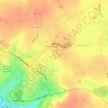
Name: Chilton topographic map, elevation, terrain.
Location: Chilton, Sudbury, Babergh, Suffolk, England, United Kingdom (52.04052 0.74012 52.06050 0.77743)
Average elevation: 62 m
Minimum elevation: 29 m
Maximum elevation: 76 m
Suffolk trails, hiking, mountain biking, running and outdoor activities
Thank you for supporting this site ❤️
Make a donation
Make a donation
Gear up for your next adventure:
As an Amazon Associate, this site earns from qualifying purchases at no extra cost to you.