
Monahans topographic map
Interactive map
Click on the map to display elevation.
About this map
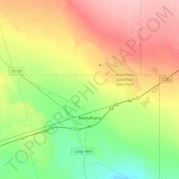
Name: Monahans topographic map, elevation, terrain.
Location: Monahans, Ward County, Texas, 79756, United States (31.56398 -103.16508 31.69572 -102.85978)
Average elevation: 827 m
Minimum elevation: 772 m
Maximum elevation: 899 m
Other topographic maps
Click on a map to view its topography, its elevation and its terrain.
Monahans
United States > Texas > Ward County > Monahans > Monahans
Monahans, Ward County, Texas, 79756, United States
Average elevation: 802 m