
Thank you for supporting this site ❤️
Make a donation
Make a donation
Gear up for your next adventure:
As an Amazon Associate, this site earns from qualifying purchases at no extra cost to you.
Aguaytía topographic map
Click on the map to display elevation.
Thank you for supporting this site ❤️
Make a donation
Make a donation
Gear up for your next adventure:
As an Amazon Associate, this site earns from qualifying purchases at no extra cost to you.
About this map
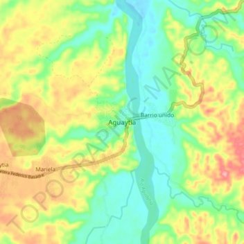
Name: Aguaytía topographic map, elevation, terrain.
Location: Aguaytía, Padre Abad, Province of Padre Abad, Ucayali, Peru (-9.07856 -75.54952 -8.99856 -75.46952)
Average elevation: 312 m
Minimum elevation: 262 m
Maximum elevation: 383 m
Thank you for supporting this site ❤️
Make a donation
Make a donation
Gear up for your next adventure:
As an Amazon Associate, this site earns from qualifying purchases at no extra cost to you.