Geolocate

Kiedrich topographic map

Click on the map to display elevation.

About this map
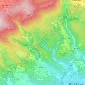
Name: Kiedrich topographic map, elevation, terrain.

Location: Kiedrich, Rheingau-Taunus-Kreis, Hesse, 65399, Germany (50.02765 8.04415 50.08765 8.10913)

Average elevation: 282 m

Minimum elevation: 93 m

Maximum elevation: 577 m

Other topographic maps

Click on a map to view its topography, its elevation and its terrain.

Dickschied

Germany > Hesse > Rheingau-Taunus-Kreis

Average elevation: 358 m

Hohe Wurzel

Germany > Hesse > Rheingau-Taunus-Kreis > Taunusstein

Average elevation: 509 m

Gear up for your next adventure:

🩹Hiking First Aid Kits - Compact medical kits tailored for trail injuries and emergencies
💧Hydration Reservoirs - Convenient water bladders for hands-free drinking on the move
🔋Rechargeable Batteries - Eco-friendly power for headlamps and older GPS units
🗺️Scratch-off Peak Maps - Track your progress climbing Munros or Wainwrights
❄️Walking Crampons - Added traction for icy slopes and winter peak bagging

As an Amazon Associate, this site earns from qualifying purchases at no extra cost to you.