Geolocate

Rendsburg topographic map

Click on the map to display elevation.

About this map
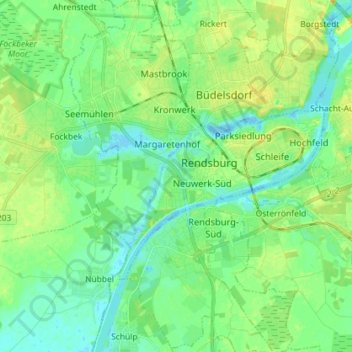
Name: Rendsburg topographic map, elevation, terrain.

Location: Rendsburg, Kreis Rendsburg-Eckernförde, Schleswig-Holstein, 24768, Germany (54.25504 9.60816 54.33876 9.71206)

Average elevation: 9 m

Minimum elevation: -5 m

Maximum elevation: 24 m

Other topographic maps

Click on a map to view its topography, its elevation and its terrain.

Gear up for your next adventure:

🖼️Topographic Map Art - Decorative 3D-effect posters of famous UK peaks and regions
👕Technical Hiking Tees - Moisture-management for high-exertion climbs
🧘Folding Sit Mats - Dry and warm seat for map-reading breaks on damp ground
🔋Solar Power Banks - Keep your GPS and phone charged during multi-day expeditions
🧢Thermal Beanie Hats - Prevent heat loss from the head in windy summit conditions

As an Amazon Associate, this site earns from qualifying purchases at no extra cost to you.