
Make a donation
Gear up for your next adventure:
As an Amazon Associate, this site earns from qualifying purchases at no extra cost to you.
Támesis topographic map
Click on the map to display elevation.
Make a donation
Gear up for your next adventure:
As an Amazon Associate, this site earns from qualifying purchases at no extra cost to you.
Támesis
Támesis is a town and municipality in the Colombian department of Antioquia. Part of the subregion of Southwestern Antioquia. Located at an elevation of 1,638 m (5,374 ft) above sea level, it was established in 1858. The local economy is based on agriculture.
Make a donation
Gear up for your next adventure:
As an Amazon Associate, this site earns from qualifying purchases at no extra cost to you.
About this map
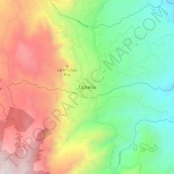
Name: Támesis topographic map, elevation, terrain.
Average elevation: 1,718 m
Minimum elevation: 778 m
Maximum elevation: 3,036 m
Make a donation
Gear up for your next adventure:
As an Amazon Associate, this site earns from qualifying purchases at no extra cost to you.