Geolocate

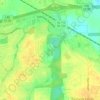
Landmarks topographic map

Click on the map to display elevation.

About this map

Name: Landmarks topographic map, elevation, terrain.

Location: Landmarks, Montgomery, Montgomery County, Alabama, 36119, United States (32.35847 -86.21441 32.39847 -86.17441)

Average elevation: 72 m

Minimum elevation: 49 m

Maximum elevation: 92 m

Other topographic maps

Click on a map to view its topography, its elevation and its terrain.
Gear up for your next adventure:

🧢Hiking Hats - Sun and weather protection for outdoor walks
🔦Keychain LED Torches - Emergency backup light for finding gear in your pack
🐕Hiking Dog Harnesses - Rugged harnesses for taking your companion on mountain trails
🚶Walking Pedometers - Simple distance tracking for casual trail walkers
🔦Waterproof LED Headlamps - Hands-free lighting for evening treks and emergency navigation

As an Amazon Associate, this site earns from qualifying purchases at no extra cost to you.