Geolocate

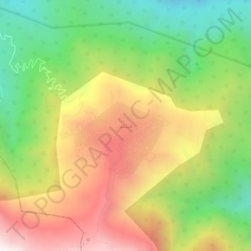
Filband topographic map

Click on the map to display elevation.

Filband

This village is located at an altitude of about 2,300 metres above sea level. Filband on the eastern side of Mazandaran is known as the roof of the province.

Wikipedia (CC-BY-SA 3.0)

About this map

Name: Filband topographic map, elevation, terrain.

Location: Filband, دهستان فیروزجاه, بخش بندپی شرقی, Babol County, Mazandaran Province, Iran (36.13388 52.50950 36.17388 52.54950)

Average elevation: 1,923 m

Minimum elevation: 1,333 m

Maximum elevation: 2,597 m

Gear up for your next adventure:

👖Packable Overtrousers - Quick-deploy rain protection for legs in sudden storms
Lightweight Solo Tents - Backpacking tents designed for wild camping in the UK highlands
🧵Survival Paracord - Multi-purpose cordage for emergency repairs and shelters
📕Outdoor Navigation Books - Learn traditional and modern navigation techniques
🕶️Polarized Sunglasses - Reduces glare from snow and water when reading terrain

As an Amazon Associate, this site earns from qualifying purchases at no extra cost to you.