
Fläsch topographic map
Interactive map
Click on the map to display elevation.
About this map
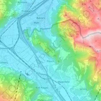
Name: Fläsch topographic map, elevation, terrain.
Location: Fläsch, Landquart, Grisons, 7306, Switzerland (47.01022 9.47579 47.06285 9.61194)
Average elevation: 925 m
Minimum elevation: 468 m
Maximum elevation: 2,543 m