

St. John's topographic map
Click on the map to display elevation.
St. John's
St. John's was laid out on a gentle slope east of St. John's Harbour. The city is bordered by primarily flat land, allowing a large network of roads to converge in the city. Due to this gentle elevation gradient, wastewater runoff is common due to poor planning along with a high concentration of high concentration of clayey loam soil above a high water table. The high water table allows for an easy source of water for the city's wells. The gentle slope also allowed for ease in constructing roads and pedestrian walkways. The coastline of the city is prone to flooding due to its low elevation.
About this map
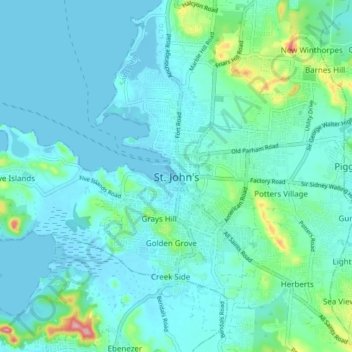
Name: St. John's topographic map, elevation, terrain.
Location: St. John's, Saint John, Antigua, Antigua and Barbuda (17.07846 -61.88485 17.15846 -61.80485)
Average elevation: 23 m
Minimum elevation: -9 m
Maximum elevation: 150 m
Other topographic maps
Click on a map to view its topography, its elevation and its terrain.
Antigua
Located in the Leeward Islands, Antigua has an area of 281 km2 (108 sq mi) with 87 km (54 mi) of coastline. The island is reputed to possess 365 beaches, one for every day of the year. The highest elevation on the island is 402 m (1,319 ft).
Average elevation: 21 m
