
Lahijan City topographic map
Interactive map
Click on the map to display elevation.
Lahijan City
Lahijan is located west of Langarud and east of Astaneh-ye Ashrafiyeh at an altitude of 94 meters above sea level. It is the third largest city in the province after Rasht and Bandar-e Anzali.
About this map
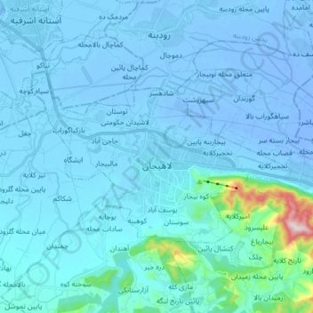
Name: Lahijan City topographic map, elevation, terrain.
Average elevation: 17 m
Minimum elevation: -18 m
Maximum elevation: 327 m