Geolocate

Amel topographic map

Click on the map to display elevation.

About this map

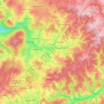
Name: Amel topographic map, elevation, terrain.

Location: Amel, Verviers, Liège, Wallonia, Belgium (50.28452 6.06987 50.40506 6.28605)

Average elevation: 516 m

Minimum elevation: 355 m

Maximum elevation: 631 m

Gear up for your next adventure:

🧭Orienteering Compasses - Accurate compasses for map-based navigation
🔥Reusable Hand Warmers - Maintain dexterity in your fingers for precise map handling
🧘Folding Sit Mats - Dry and warm seat for map-reading breaks on damp ground
🛰️Handheld GPS Devices - Reliable GPS units for hiking and outdoor navigation
🗺️Topographic Maps - Detailed maps showing elevation and terrain features

As an Amazon Associate, this site earns from qualifying purchases at no extra cost to you.