
Thank you for supporting this site ❤️
Make a donation
Make a donation
Gear up for your next adventure:
As an Amazon Associate, this site earns from qualifying purchases at no extra cost to you.
dhanaula topographic map
Click on the map to display elevation.
Thank you for supporting this site ❤️
Make a donation
Make a donation
Gear up for your next adventure:
As an Amazon Associate, this site earns from qualifying purchases at no extra cost to you.
About this map
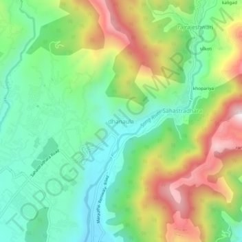
Name: dhanaula topographic map, elevation, terrain.
Location: dhanaula, Dehradun, Uttarakhand, 248009, India (30.36354 78.09807 30.40354 78.13807)
Average elevation: 1,011 m
Minimum elevation: 751 m
Maximum elevation: 1,451 m
Thank you for supporting this site ❤️
Make a donation
Make a donation
Gear up for your next adventure:
As an Amazon Associate, this site earns from qualifying purchases at no extra cost to you.