
Janny Wood topographic map
Interactive map
Click on the map to display elevation.
About this map
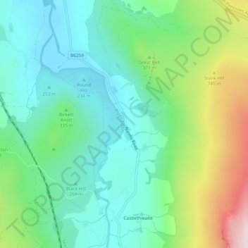
Name: Janny Wood topographic map, elevation, terrain.
Average elevation: 329 m
Minimum elevation: 212 m
Maximum elevation: 611 m
Other topographic maps
Click on a map to view its topography, its elevation and its terrain.
Black Fell Moss
United Kingdom > England > Cumbria > Eden District > Mallerstang
Black Fell Moss, Mallerstang, Eden District, Cumbria, England, CA17 4JX, United Kingdom
Average elevation: 588 m