Geolocate

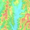
Canelli topographic map

Click on the map to display elevation.

About this map

Name: Canelli topographic map, elevation, terrain.

Location: Canelli, Asti, Piedmont, 14053, Italy (44.68522 8.25491 44.75507 8.31700)

Average elevation: 248 m

Minimum elevation: 140 m

Maximum elevation: 519 m

Other topographic maps

Click on a map to view its topography, its elevation and its terrain.

Gatti

Italy > Piedmont > Asti > Rocchetta Tanaro

Average elevation: 165 m

Sant'Andrea

Italy > Piedmont > Asti > Cerreto d'Asti

Average elevation: 270 m

Zolfo

Italy > Piedmont > Asti > Montafia

Average elevation: 226 m

Gear up for your next adventure:

🔦Outdoor Torches - Reliable torches for night navigation
🔦Waterproof LED Headlamps - Hands-free lighting for evening treks and emergency navigation
⛺Camping Shelters - Emergency and lightweight shelters for outdoor use
🧣Fleece Neck Warmers - Extra insulation for winter topographic surveys
☕Insulated Travel Mugs - Keep drinks hot while surveying the landscape from a summit

As an Amazon Associate, this site earns from qualifying purchases at no extra cost to you.