
Thank you for supporting this site ❤️
Make a donation
Make a donation
Gear up for your next adventure:
As an Amazon Associate, this site earns from qualifying purchases at no extra cost to you.
Mansimbal topographic map
Click on the map to display elevation.
Thank you for supporting this site ❤️
Make a donation
Make a donation
Gear up for your next adventure:
As an Amazon Associate, this site earns from qualifying purchases at no extra cost to you.
About this map
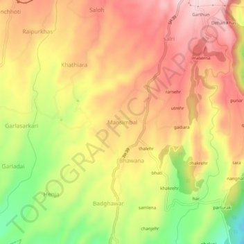
Name: Mansimbal topographic map, elevation, terrain.
Location: Mansimbal, Palampur, Kangra, Himachal Pradesh, 176085, India (32.03106 76.47718 32.07106 76.51718)
Average elevation: 968 m
Minimum elevation: 814 m
Maximum elevation: 1,075 m
Thank you for supporting this site ❤️
Make a donation
Make a donation
Gear up for your next adventure:
As an Amazon Associate, this site earns from qualifying purchases at no extra cost to you.